

Scientists say heavy rainfall and flash flooding are gradually becoming the new norm, largely as a result of climate change and global warming. Extreme weather events are happening more frequently, according to the latest UK State of the Climate report.
Research shows the UK’s already wet climate is set to get even wetter in future if we don’t act now to halt global warming. The stark picture of how climate change will affect our life in years to come shows sea levels are steadily rising.
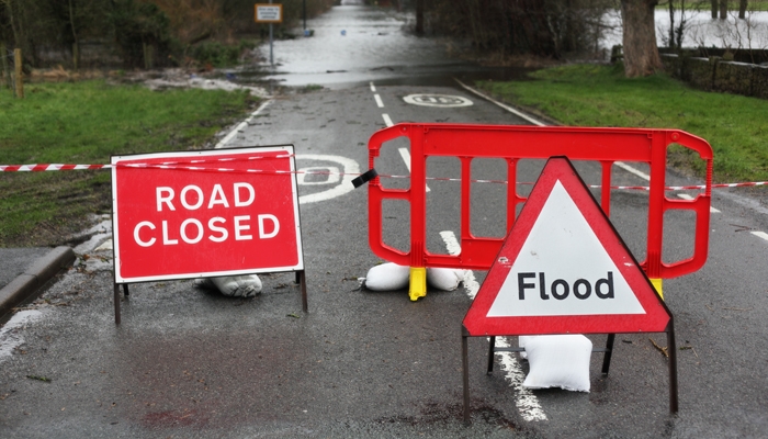
© Brian A Jackson / Shutterstock.com
A new map of how the UK could look in 2050 predicts a number of British seaside resorts may be submerged under water. Coastal and low-lying areas that are already vulnerable to flooding could disappear altogether in 30 years’ time.
Flooding threat
The areas most at risk include parts of North Wales; low-lying areas of South Wales, such as Cardiff and Swansea; most of the flat, low-lying land between Peterborough and King’s Lynn on the east coast of England; and resorts on the south coast, say climate change experts.
Areas surrounding the Severn Bridge, such as the M4 motorway, could also be submerged, says Climate Central.
The UK’s sea level has already risen a massive 16.5 cm since 2000, suggesting climate change is accelerating due to global warming. Six of the ten wettest years in the UK since records began have occurred since 1998. The wettest February in history occurred in 2020.
The temperature in the past decade has been an average of 1.1°C higher than it was in the three decades between 1960 and 1990. In 2020, we experienced the sunniest spring since records began. In addition, the season when trees are in leaf has grown 6.2 days longer in the 21st century.
Is heavy rainfall increasing?
Everything points to the fact climate change is accelerating. With it comes more heavy rain, flash flooding and the associated damage to property and possessions.
The UK State of the Climate report confirms our climate is becoming wetter. Currently, the highest total rainfall over a five-day period is 4% higher than it was in the three decades between 1960 and 1990.The amount of rain has increased by an average of 17% compared with the same period.
The number of consecutive wet days in the UK has also increased in recent years. Changes in rainfall are the largest in Scotland.
The report says human influence on the climate is increasing the chance of heavy rainfall events. The risk of flooding in England and Wales has increased by at least 20%. In 2000, we experienced the wettest autumn since records began. Some regions received double their normal amount of rainfall.
Severe storms wreaked havoc between 28th October and 4th November 2000, when 10,000 homes were flooded in 700 locations. The rivers Trent, Thames, Severn, Dee and Wharfe were at their highest levels for 60 years, while the River Ouse in Yorkshire reached its highest level since the 17th century.
Large areas of Kent, Sussex, Shropshire, Yorkshire and Worcestershire were under water as England and Wales suffered their highest precipitation record in history. There was an average of 503 mm of rain between September and November, almost 50 mm higher than the previous record.
Winter 2013/14 and winter 2015/16 were the two wettest on record. The Met Office says the chances of a long period of extreme rainfall in winter is now seven times more likely as a result of climate change.
Storm Desmond, in December 2015, was the wettest and worst since 1910. Rainfall reached up to four times the average in the north and west of the UK. Severe flooding caused widescale property damage in Cumbria in particular. Now, scientists say the heavy rainfall associated with Storm Desmond is up to 60% more likely due to climate change.
Flash flooding
Sudden heavy rainfall brings the threat of flash flooding when the rain falls so fast that the underlying ground and drains can’t drain it away quickly enough. In a very short time, roads can become like rivers. If the rain continues at such a rapid rate, it can carry cars away and flood buildings.
Summer thunderstorms are important when it comes to projecting flash flooding. Summers, in general, may become drier and hotter, but when a storm comes, the rain will fall in sudden, heavy bursts, creating the ideal conditions for flash flooding.
Rivers normally flow fairly gently towards the sea, so when they flood, this can happen quite slowly. This gives local residents some warning, enabling them to protect their property, or evacuate if necessary. In the case of flash flooding, there’s often no warning that the heavy rain is about to turn into an unwelcome disaster.
It can occur in many different conditions, including where rivers are narrow, steep and fast-flowing; in smaller rivers in built-up urban areas, where the roads and concrete don’t allow water to drain into the ground; and in areas where local drainage systems are easily overwhelmed.
According to climate reports, the only way we can slow down or prevent this future scenario is to change our lifestyle. Businesses and individuals are urged to act now. To reduce the threat of heavy rainfall and flooding in the future, we must slow down global warming and reduce the carbon dioxide emissions that are creeping into the atmosphere.
In the event of an emergency
If your property suffers serious flooding, Furniture Rental Online provides emergency furniture.
First, contact your insurer to make a claim and then contact us. We can help insurers, loss adjusters and claims handlers to deal with your claim quickly and efficiently in the event of a flooding emergency.